Spatial Planning and Analysis

Work Package 4

Leaded by AUTh

PARTICIPANTS

FOCUS

Its objective is twofold, namely: (a) the efficient transferring of knowledge and enhancement of skills related to renewable energy resources’ spatial planning/analysis and decision making methods, processes and tools and (b) the development and the application of methodologies and tools in sustainable energy planning enhancing the active public participation and involvement. The first objective will be achieved through autonomous studying/learning of seconded staff and through the appropriate training of seconded staff on spatial analysis tools, earth observation monitoring and multi-criteria analysis methods. For achieving the second objective, an online geographic information system (web-GIS) will be designed and implemented. The potential of using all the above tools in sustainable energy planning and their versatility and efficiency will be illustrated through their application on specific Case Studies corresponding to areas with different geographical, spatial and social characteristics, as well as to the exploitation of different renewable energy sources.

OBJECTIVES

01. Transfer of knowledge and enhancement of skills related to Renewable Energy Source (RES) spatial planning/analysis and decision making methods, processes and tools.

02. Development of advanced methodologies and tools in RES spatial planning/analysis and decision making incorporating public participation and involvement.

TASKS

1.

Best Current Practices on REL spatial planning/analysis and decision making methods (BCP). This task focuses on critical knowledge transfer and skills enhancement relevant to BCP spatial analysis/planning tools (e.g., ArcGIS, QGIS, EO monitoring (xyz-time-4D) using Remote Sensing techniques) and methodologies (e.g., 3D mapping, multicriteria analysis methods (AHP, TOPSIS)) and spatial database management (e.g., CAD files, terrestrial sensor input, UAV data) for REL.

2.

Advanced Methodologies in Sustainable Energy Planning (SEP). Enhancement of existing energy planning methodologies in terms of: (a) spatial criteria selection and inclusion of policy aspects and (b) public engagement reinforcement in SEP. Spatial planning/decision making stages, where the public is anticipated to be most involved and public involvement best practices (e.g., web platforms, questionnaires, etc) will be identified. Integration/combination of the crowdsourcing concept within spatial planning tools. An online geographic information system (web-GIS) based on Service Oriented Architecture (SOA) will be designed and implemented in relation to WP1 and WP6.

3.

Web-GIS platform (W-GIS). Application of the methodolgoies/modules to specific Case Studies via the web-GIS platform. With the aim of demonstrating the versatility of methodologies irrespective of geographical spatial and/or social factors, Case Studies with different characteristics will be defined (e.g., different country, different critical planning parameters, such as the planning scale (national, regional or local); different renewable energy source exploitation). The required spatial data will be collected, the modules on enhancing public participation will be applied to specific public target groups and, finally, GIS tools including the web-GIS and decision making methods will be applied for the sustainable planning of various renewable energy technologies in WP4 participant countries.

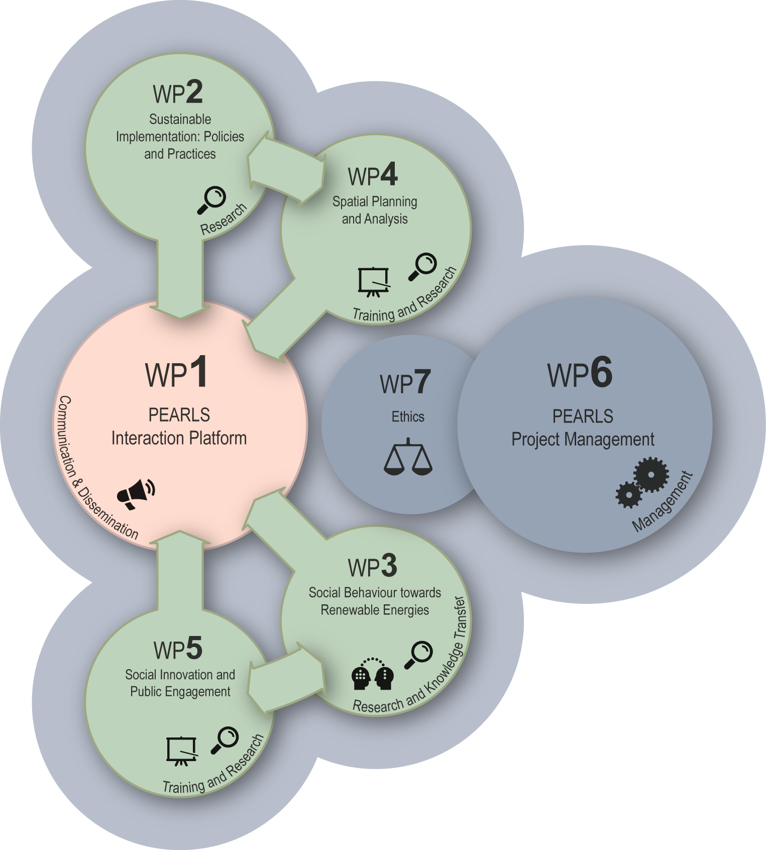
WORK PACKAGES RELATED

e-mail: eusoclab@us.es

Address: Avda. Ciudad Jardin, 20/22, 1ª pta.      41005 Sevilla (España)

______________________________________________________________________________

Funded by: Marie Sklodowska Curie Actions. H2020 Research Innovation Staff Exchange (RISE)

Project Number: 778039 - PEARLS

This project has received funding from the European Union’s Horizon 2020 research and innovation programme under the Marie Skłodowska-Curie grant agreement No 778039.

Contact Us

11 + 13 =